Tenaya Creek Slide & Tuolumne Meadows
Aug. 23rd, 2023 11:01 pm For the third day of our trip, Cade and I went to the Tenaya Creek Slide in Yosemite, which is a massive natural waterslide where Tenaya Creek flows over a vast expanse of solid granite downstream of Tenaya Lake on its way to Yosemite Valley. The creek is very seasonal and normally dries up by the end of July. However, the record snowpack made it difficult to predict when the seasonal creeks would dry up this year, so I was hoping it would still be running in late August. I could see from Glacier Point on Monday that Tenaya Creek was definitely flowing, so I knew we were good to check it out today.
Before we went to the slide, I wanted to do some recon on the upper Tuolumne River for possible future excursions. I had originally thought about hiking to Glen Aulin on this trip, which is on the Tuolumne River a few miles downstream of Tuolumne Meadows. However, this section of the river actually has a temperature gauge, and it indicated the water temperature was currently in the 50s (as opposed to upper 60s or even low 70s in low/normal snowfall years). It had been about 60 °F before the storms came through on Sunday and Monday, but I’m guessing the rain must have washed some of the snowmelt into the river and made it colder. Still, I wanted to get a look at some of the closest swimming holes to the road just to get an idea of what the geology and water clarity looked like in person. It looked like we could get a sneak peek by hiking about a mile on the Pothole Dome Trail to where the river flowed over some exposed bedrock on the downstream end of Tuolumne Meadows. I was also interested in seeing a little bit of the Lyell Fork Tuolumne River, as it looked to have clear, blue water, and I had marked one point of interest on Google Earth near a footbridge about a mile upstream of the road at the Tuolumne Lodge.
After we ate breakfast, we entered the park and drove up Tioga Road, which boasted a bunch of scenic granite mountains and domes. Our first stop was the Lyell Fork Tuolumne River. It was a relatively flat hike to get there, but it ended up being almost a mile to the footbridge.

The water temperature was 50.5 °F, and the air was in the low 60s, so no swimming here. We walked up a narrow path next to the river a few hundred feet to check out the point of interest.

It looked pristine, and possibly deep enough for swimming, but I wasn’t getting into water that cold today.

Here's a video of the footbridges and the point of interest:
We returned to the car and headed back down the road to the Pothole Dome Trail, which is on the west end of Tuolumne Meadows.


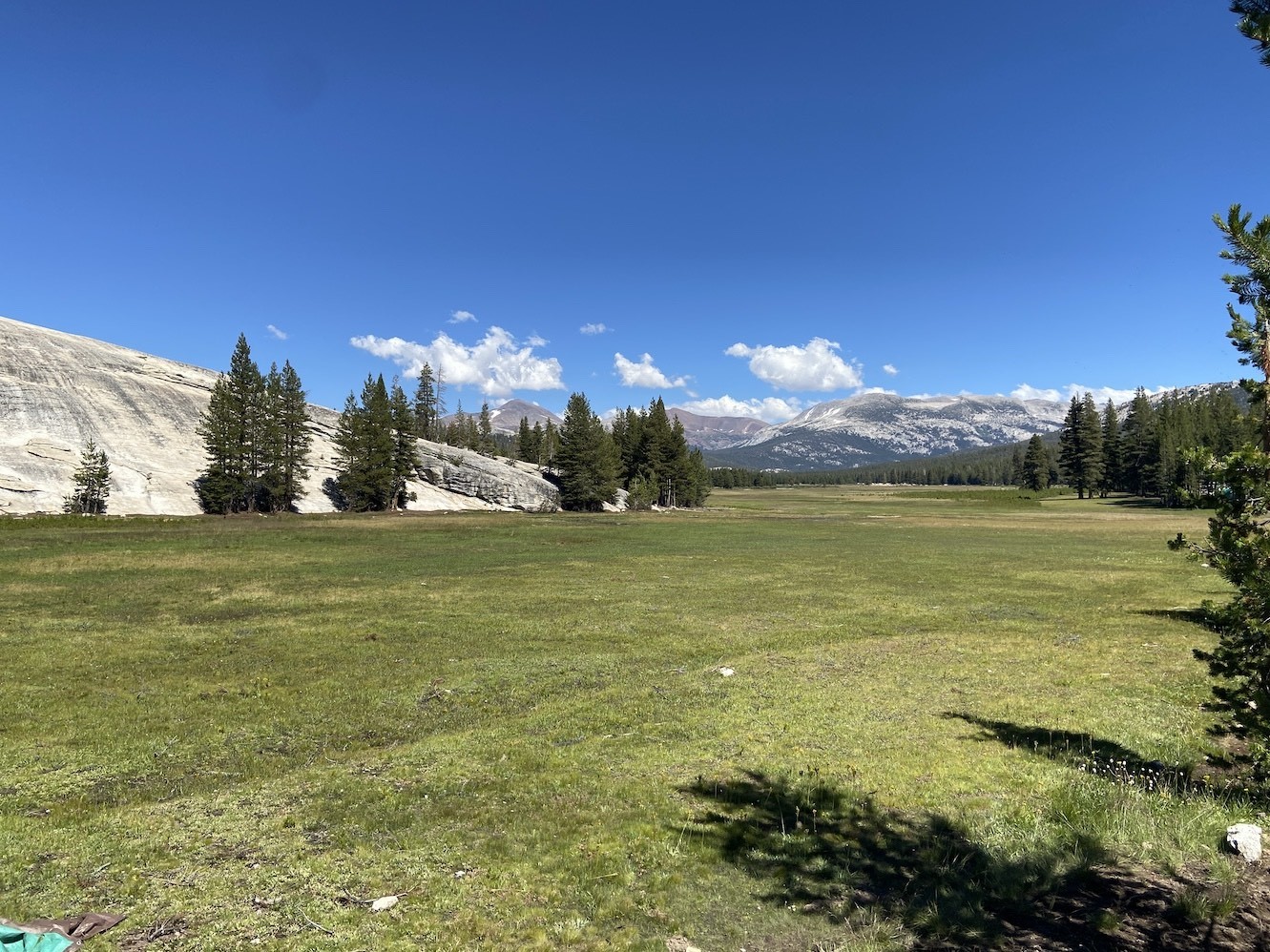
We took the trail a little over a mile around the edge of the dome to a point where the Tuolumne River exited the meadow and flowed over exposed bedrock.


It looked calm flowing through the meadow, but we could tell by the amount of water going over the first cascade that the flow was still very strong. The water temperature here was 54 °F. I walked downstream along the bedrock a little ways and could see that there were some more small cascades and pools downstream, but it was after 2 PM, and I wanted to leave enough time for the Tenaya Slide, so we headed back to the car. Along the way, we stopped to take pictures of a bunch of deer in the meadow. We tried taking pictures through my binolculars, and this is what we managed to pull off.

___
After we returned to the car, we drove back down to the trailhead for the Tenaya Creek Slide. Well, technically there is no legit trail, but we started on an official trail and branched off onto a faint side path when the main trail started veering away from the creek. We followed it downstream on faint paths and exposed rock faces.

After about a mile, the creek squeezed between two sloped rock walls and spilled over a waterfall into a sweeping granite bowl.

We had to work our way about 100 feet down the steep rock face to the base of the waterfall, which spilled into a large, deep tub.

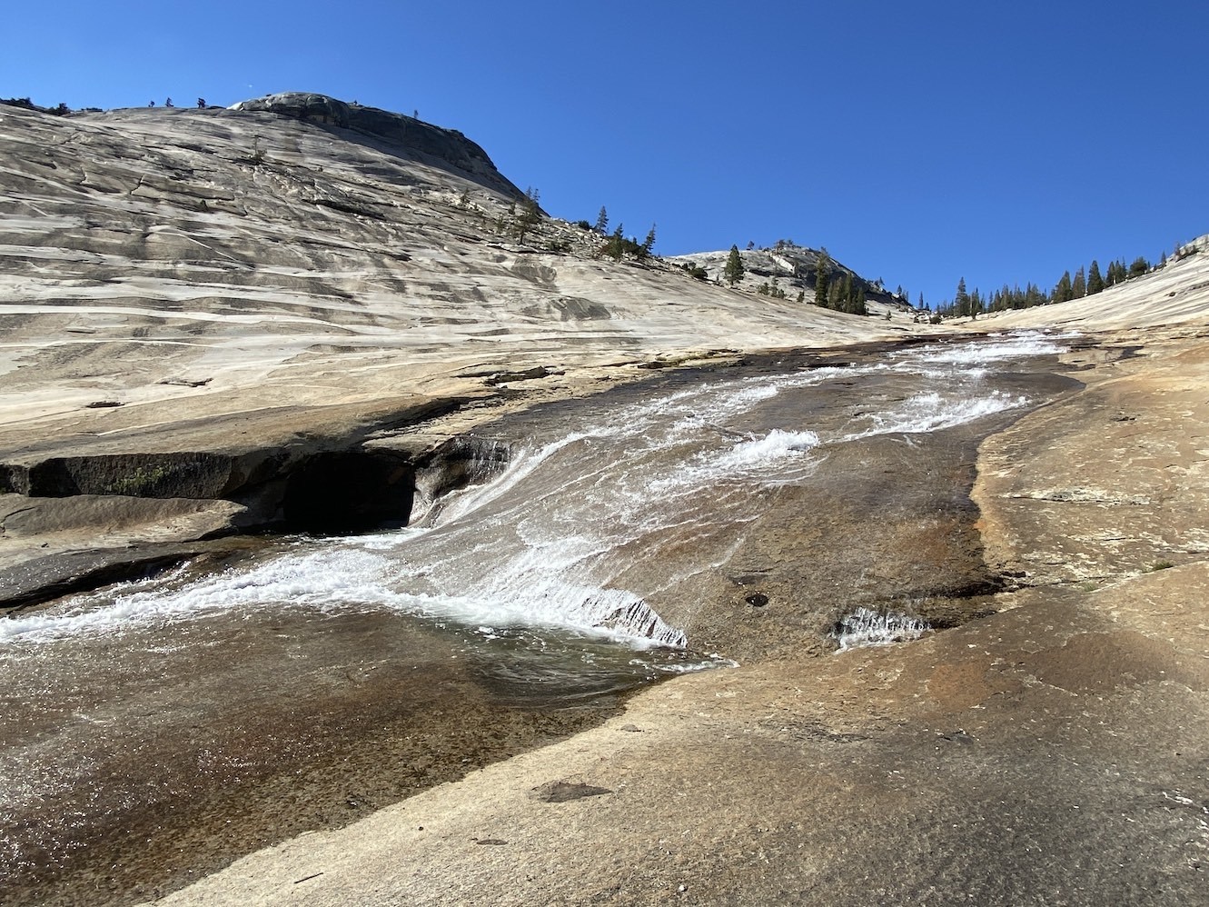
From there, the creek continued sliding a couple hundred feet down the granite bedrock.


There were a couple more tubs on the way down, one of which looked possibly big enough to swim in.

After this tub was the slidable portion of the cascade.

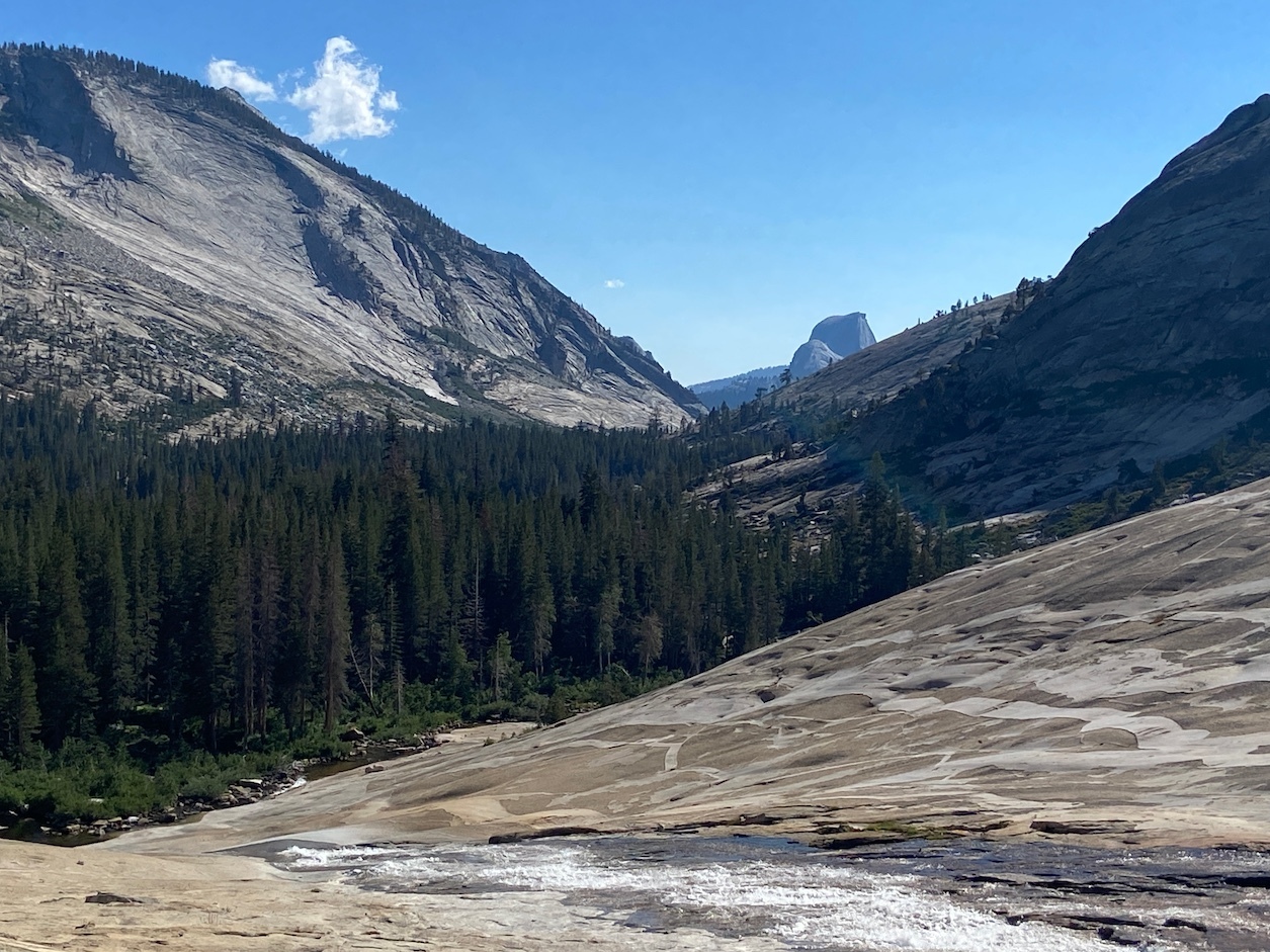
At the bottom of the slide, the creek flattened out and made a 90-degree turn toward Yosemite Valley (note the Half Dome in the background):

There was a group of people there, and a foreign family who had been behind us on the “trail” arrived also. One of the guys from the group who was already there was trying to tell me where to slide to avoid bumps and ledges, but I couldn’t hear him over the water, so I went down to the bottom to look. There was one bump on the very river-left side, and a six-inch ledge toward the middle. The entire right side looked too bumpy for sliding, so it appeared that the only safe path was between the left bump and the middle ledge. I tried this from almost all the way down, but the current kept pushing me off the sweet spot and running me into the left bump. After a few more attempts and starting from higher up, I managed to get into the sweet spot a few times.


One of the kids from the foreign family managed to get a direct path every time by turning almost on his side and sliding on his hip to avoid the current, and then spinning around backward. I only managed to succeed at this maneuver a couple of times, but I could tell it was going to bruise my hip if I did it too much. Cade didn’t try it because he didn’t want to get wet.
Here is a video of the entire cascade from the upper waterfall to the lower slideable portion:
We moved to the first pothole upstream of the slideable portion, and I went behind the waterfall, at the recommendation of the guy who had told me about the ledge on the slide.

This pool was mostly shallow and full of boulders, and the 60-degree water constantly raining down on my head gave me brainfreeze.
The guy who talked to me when we first arrived said the Tenaya Creek slide was only slidable about three weeks out of the year, and the flow was lower than ideal at this point. He asked how we found out about it, thinking one of the locals must have told us, as the directions are not posted on the internet. I said we actually knew of it from a travel book (Swimming Holes of California Pro Tour by Timothy Joyce). I asked if there was an easier way out of here than climbing up the rock face next to the waterfall, and he said we could swing around the far side of the dome on the river-left of the falls and reconnect with the creek upstream of it.
On the way up, I decided to get into the deep pool below the waterfall to cool off before the climb up. I looked under the water with my diving mask, and it looked 12-15 feet deep in most areas, except for the small pothole near the back of the pool, which was shallow. I jumped in from the side a couple of times, and then I ran to an area of the exposed rock where the sun was hitting, as I had over-cooled myself by staying in the water too long. I was feeling a little lightheaded from the cold as I dried my feet off and put my hiking boots back on. Plus, the air temperature was only in the 60’s at this elevation with a stiff breeze blowing. Everyone was leaving at this point. The foreign family went straight up the side of the dome (the way we had come down), and the other group of people stopped at the waterfall tub for a dip. One of them climbed on top of the back pothole and jumped into the pool.
We took the guy’s advice and swung wide around the dome instead of climbing straight up it, which was probably less strenuous than the alternative. The hike back to the car seemed a little quicker than coming in. The mosquitoes were all over me the entire time (many of them lost their lives).
After getting back to the car, we drove the hour and fifteen minutes back to the hotel and then ate dinner again at the Lucky Buck Café. The food there is decent, but their evening crew has atrocious service.
In summary, the Tenaya Creek slide was an okay natural waterslide, but it wasn’t great for butt-sliding at today’s flow due to the difficulty of getting an obstacle-free route to the bottom. It would probably be best enjoyed on an innertube or some kind of inflatable device that can pad the bumps and open up more paths to the bottom. I had thought this was just going to be a slide, as the pool at the bottom was only about three feet deep, but the rock pool at the base of the upper waterfall was a legit swimming hole. Before coming here, I was wondering how one might use Yosemite Falls as an indicator of whether Tenaya Creek is still flowing (since Yosemite Falls has a live webcam that streams 24/7). Yosemite Falls was still flowing strongly two days ago, as was Chilnualna Creek yesterday, while Tenaya Creek was flowing more gently today. Therefore, I would guess that Tenaya probably dries up before Yosemite and Chilnualna Creeks do, meaning that most ephemeral streams in the park would probably be too high and cold for swimming when Tenaya is at optimal flow.
As for the Tuolumne River, I would be interested to explore more of it and hike to Glen Aulin in a drier year when the water is lower and warmer (it apparently gets up to 70 °F some years, according to its temperature gauge), but there was no way it was going to be pleasant under today’s conditions.