Linville Gorge - Conley Cove area
Jun. 17th, 2023 11:59 pm After driving up to the mountains last weekend, I was looking forward to a lazy weekend at home, but the forecast turned to totally sunny. However, it's supposed to be pretty rainy after this, so I figured I should take advantage of the nice weather now and chill at home when it’s rainy. Today, I continued my explorations of lower Linville Gorge by checking out some swimming holes near the Conley Cove Trail. I had scanned the 8-ish mile stretch of river between the Conley Cove Trail and Lake James on Google Earth and marked 14 points of interest (POIs), numbered in order from downstream to upstream. Last weekend, I checked out POIs 1-3, which are the farthest downstream. POIs 4-12 are located on the ~3.5 mile stretch of river between the Pinch-In Trail (on the downstream end) and the Conley Cove Trail (on the upstream end), and 13-14 are just upstream of the Conley Cove Trail. The river is easier to see from the Linville Gorge Trail (LGT) when the leaves are off the trees, so I had originally planned to scout out POIs 4-12 over Christmas break, but I got sick and wasn't able to. I decided to go ahead and knock out a few of the upstream POIs on a summer out-and-back hike, which will leave more time to explore the ones in the middle on a future thru-hike. My plan for today was to definitely check out POIs 11-14, and possibly continue as far downstream as POI 9 depending on how I was doing on time. I decided to start on the upstream end and work my way downstream, since it looked like POIs 13-14 would lose sunlight earlier in the day.
I had decided if I left Raleigh by 9:00 AM that I would go to Linville Gorge, but otherwise I would hit Harper Creek. I was actually more interested in the latter, but conditions on the Linville River are not always hospitable for swimming like they were today, so I opted to take advantage of it. After replacing my phone's broken car charger from last weekend, I thought I had everything in order for this trip, but then my cruise control decided to stop working right at the beginning of the drive (first world problems, I know, but what a drag). I drove about 20 minutes out of the way (according to Google Maps) to come in from the top of Old NC 105 rather than drive up from the bottom, because I wanted to reduce the amount of dirt road driving to get to the Conley Cove Trailhead. However, the road coming in from the top was pretty rough. I bottomed out once. I made it past the point near the Cabin Trailhead where we had to get out and walk on my 2021 winter scouting trip, but there was one downhill section just before the Babel Tower Trailhead (I think) that was very steep and rutted. A jeep was trying to come up at the same time I was going down, and they were spinning tires. I was already committed by the time I realized my car probably couldn’t make it back up this (I apparently did in 2017, but the road may have been in better shape then), which meant I was now going to have to go out the bottom way, so I was hoping there wasn’t an impasse between here and there. The road was also pretty steep going downhill after Wiseman’s View, with about 800 feet of elevation loss, so now I was really committed to exiting the bottom way. When I got to the Conley Cove Trailhead, I saw a Hyundai Ionic parked there (which has lower ground clearance than my Camry). I figured that was either a good sign, or misery was going to have company later this evening.
The Conley Cove Trail was fairly moderate as far as Linville Gorge rim-to-river trails go. Most of them are a balls-to-the-wall straight drop to the bottom, but this one had switchbacks all the way down, which I don’t think I’ve seen on any other gorge trails. The upper section of the trail descended between two sections of cliffs and down a lush (including nettle and poison ivy), shaded hillside, complete with trickling stream sounds and birds singing.


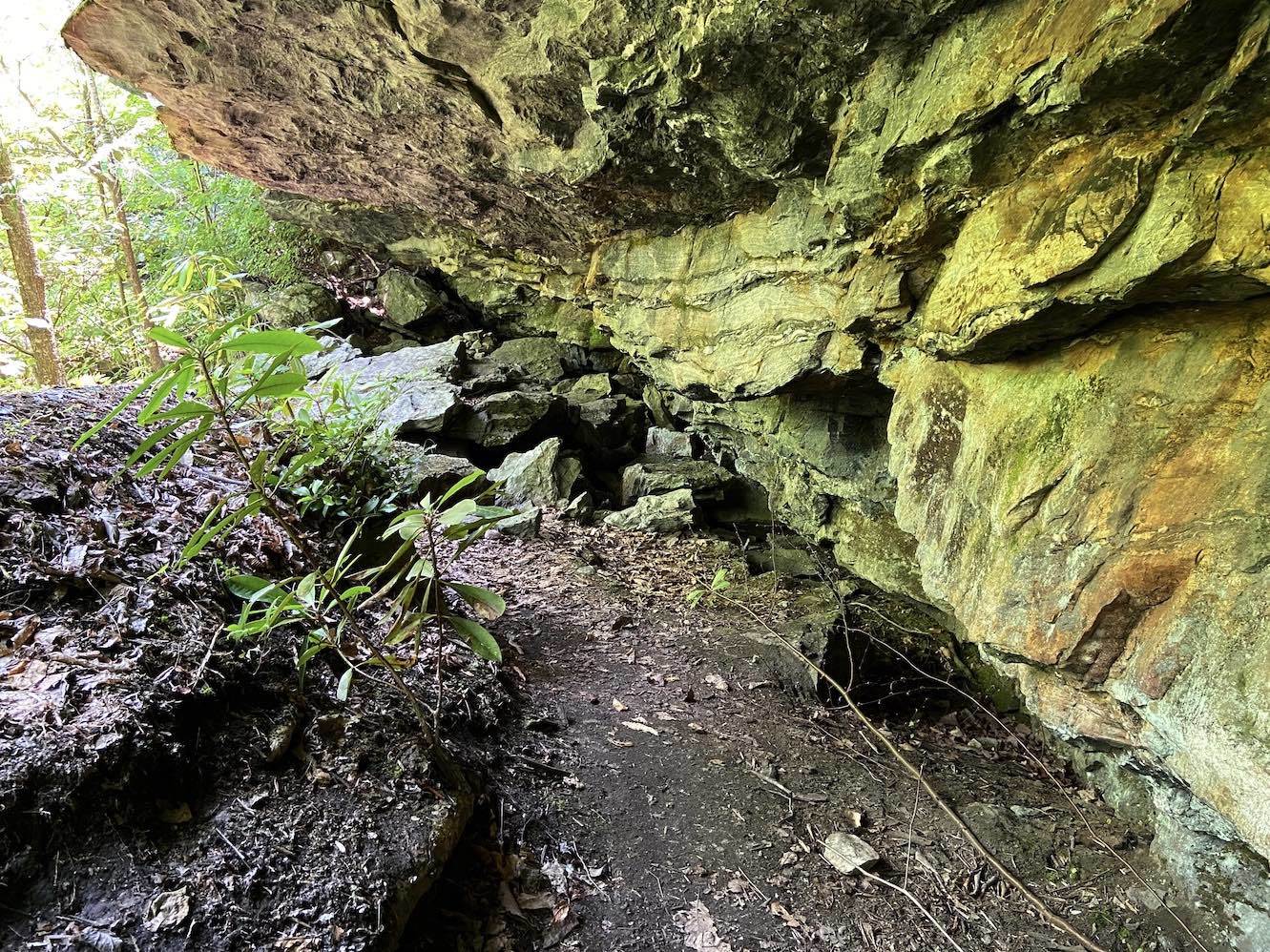
It looked like the trail was hemmed by cliffs for a fair portion, but the summer foliage made it hard to see them. According to my fitness tracker, I reached the LGT in 1.3 miles / 40 minutes. The trail ran right along the riverbank in this area.
POI 13 was just upstream of the junction, so I checked it out first.


It was a fairly large pool with a bunch of campsites next to it. I didn’t get in, but it was almost certainly a legit swimming hole because there were people in swimsuits sunbathing on the large rocks on the upstream end. There didn’t appear to be any vertical elements, and there was nothing geologically intriguing about it, so I continued upstream.
POI 14 was between two rapids called Nikki’s Notch (aka Keyhole) and Surprise Funeral. I didn’t boulder-scramble all the way to the river’s edge to look at Surprise Funeral, because I could tell from where I was that it didn’t have a swimming hole. Looking upstream, I could tell that POI 14 was definitely a legit swimming hole, because there were three guys sitting on one of the flat boulders in the middle, and one of them jumped into the water and went under.

The swimming hole was spotted with boulders, and it had a small but turbulent-looking pool that was dammed by two of the boulders where a rapid fed in.

I continued upstream to look for Nikki’s Notch. I’m not sure if it was the rapid that fed POI 14, or if it was a tad further upstream, but I walked out onto a boulder and didn’t see any other swimming holes upstream. I thought I saw the cliffs above Cathedral just ahead, but I didn’t continue up to it since I was mostly focused on finding new spots.
POI 14 looked enticing, but I wasn’t ready to change into my water shoes, so I went back downstream to check out some of the other POIs. POI 12 was a legit swimming hole behind a large campsite, but several people were swimming there, so I continued downstream. POI 11 was right next to the trail and was also a legit swimming hole but not terribly spectacular, so I continued on.
POI 10 didn’t look like it had any swimming holes.
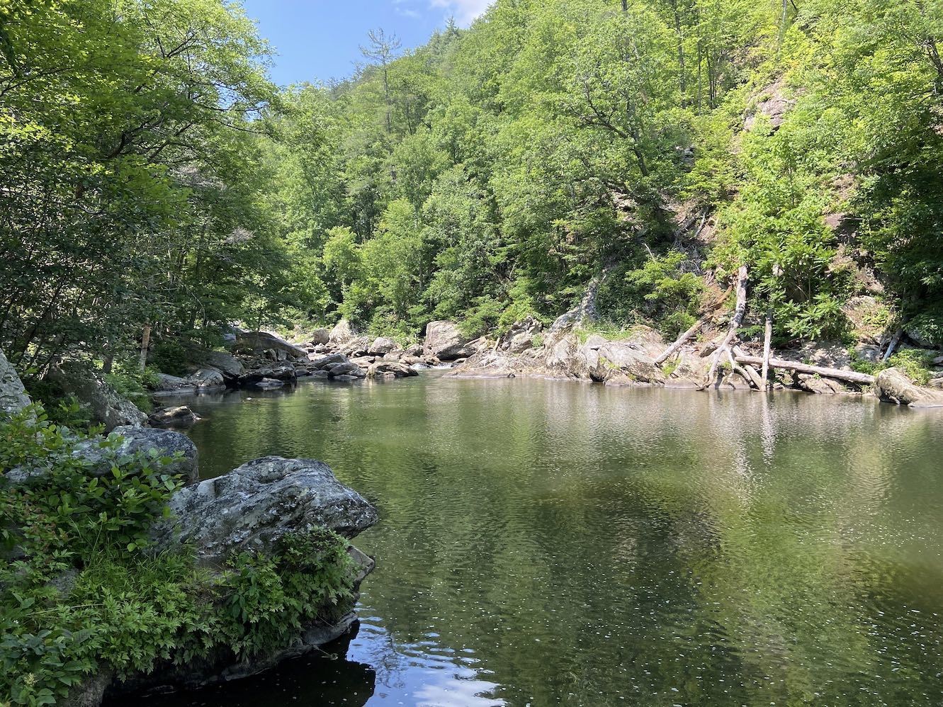
After this, the trail climbed above the river and came back down to it at POI 9. I could tell from the shore that it was deep enough to be a legit swimming hole, but it was cluttered with underwater boulders and didn’t have any major vertical elements.


I was so hot and sweaty by this point that I considered jumping in, but I wanted to keep my hiking boots on for the rugged stretch of trail between POIs 9 and 10. I thought I might try to get to POI 8, but I started walking downstream and saw on the GPS that I still had about a quarter mile to go. I think the massive cliff in the distance is the North Carolina Wall; I wonder if I could hike along the edge of it and see POIs 5-8 through binoculars?

I decided to turn back, because 1) I was tired, and 2) sun and water were beckoning. I decided I would swim at POIs 11 and 12.
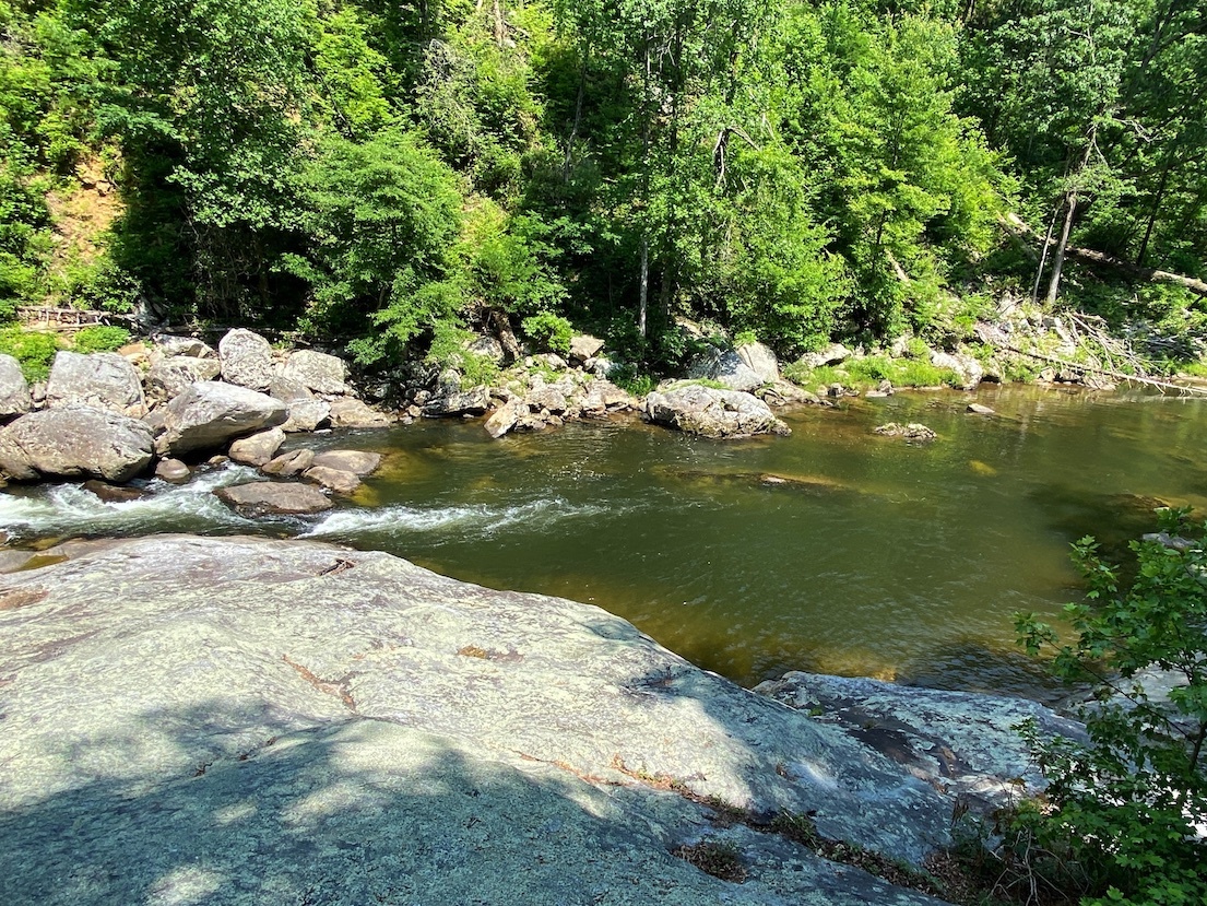
POI 11 had no major vertical elements, but it did have a large rock slab on the upstream end.


I snorkeled the pool, and the water was shallow all around the slab, meaning it was not a jumping option.

I forgot how deep the water was in the middle of the pool, but it was over my head. I checked the area beneath the flat rock on the river-left side of the pool to see if a low jump would be possible here, but there was only a small pocket about eight feet deep beneath it with large boulders sticking up all around.
The guys who had been swimming at POI 12 showed up at POI 11, so I decided to go to 12 since it was now vacant. It was about 4:30 PM, and direct sunlight was slowly fading. POI 12 looked like the most likely of the POIs to have a significant jump.


There was a rock bluff about 15 feet high on the river-left.

I snorkeled beneath it, but the water was six feet deep or less up against it. The bottom dropped down to about 9 feet in the middle of the pool, but you would have to jump out pretty far to make it, and even then, the water might be a little shallow relative to the height of the jump. I was getting cold and tired at this point, and the pool was mostly in the shade, but I could see that the river-left shore was still getting plenty of sun just around the bend upstream. I tried to make my way there without getting back into the water, but the rocks were covered in poison ivy, so I swam back across the pool and walked a short distance upstream on the trail. There was no swimming hole there, but I found a warm boulder on the river-left to sunbathe on. I lay there soaking up sun until about 5:50 PM. I was warm again by this point, so I decided I should get back in the water to cool off before the hike out.
I decided to go back to POI 14, but it was now fully shaded. I snorkeled it, and it was at least 8 feet deep in some areas (like where I had seen the guy jump in earlier), but it was shallow near any potentially significant jumps. I climbed to the top of the large, triangular boulder on the opposite side of the pool and looked upstream to see if I had missed anything earlier, but I didn’t spot any additional swimming holes.

I changed back into my hiking boots and began the hike out. There were a man and his two daughters in front of me, but they let me pass. It was exercise, but nowhere near as strenuous as ascending the White Oak Stand or Devil’s Hole Trails. I made it up in exactly the same amount of time I made it down: 40 minutes. There was now a Honda Fit in the parking area, so either I was going to be fine, or we were all going to have a "stuck in Linville Gorge" party.
I knew the road was going to climb 400 feet between here and the Pinch-In Trailhead, and I was not enthused to discover how it was going to do that. I don’t think I came across anything quite as bad as I did on the way in, but there was one steep uphill section where my tires were spinning. There was also a steep downhill section where I encountered a dune buggy or something coming up, and they backed all the way down to let me go. This spot was so hairy that a brief section of the road was actually paved. I could tell there were some sweet views in this area, but they were all obstructed by people parking their vehicles in the pull-outs and setting up camp (even if they weren’t campsites). The best view was blocked by some guy in a large van with his two growling dogs sitting there. In fact, every single roadside campsite I saw was taken. I don’t think I’ve ever seen so many people at Linville Gorge (granted, it's a Saturday evening). Anyway, once I reached the White Oak Stand Trailhead, I knew I was in the clear. There was even a car parked there. Poor person... they’re going to detest their existence on the way up.
After I finally reached the paved road (and silently thanked the dear lord), I drove to Lenoir and got Jersey Mike’s before checking into my hotel.
In summary, I found some legit swimming holes today, but as with last weekend, none were terribly interesting. POI 14 was probably the most geologically striking by this excursion’s standards, but it’s just carry-over from Cathedral Gorge. If you’re going to come this far, then you might as well swim at the superior Cathedral just upstream (granted, for all its awesomeness, Cathedral loses sunlight fairly early in the afternoon). POI 12 was probably the runner-up for today, boasting a potentially doable jump of about 15 feet, but you’d have to jump out pretty far or you might break a leg. POIs 9, 11, and 13 were also legit swimming holes but were basically just deep spots in the river with no bells or whistles.
Today’s excursion has me thinking twice about trying to do a thru-hike from the Pinch-In to the Conley Cove Trail. In hindsight, I (or my car, rather) probably would have been better off if I had used the Spence Ridge Trail and just hiked the extra couple of miles. My car made it through today (although it took some abuse), but that was partly because the road was bone-dry. I don’t think I would attempt the section of road between the Cabin and Pinch-In Trails again without four-wheel drive, and that would mean wrangling two people with four-wheel drive vehicles. And from what I've seen so far, the swimming holes on this section of the river haven’t been terribly interesting, so it may not be worth the effort. As for the Conley Cove Trail itself, I would say it was a tad more strenuous than the Spence Ridge Trail, but not as bad as the Devil’s Hole, Cabin, and Unnamed (White Oak Stand) Trails.