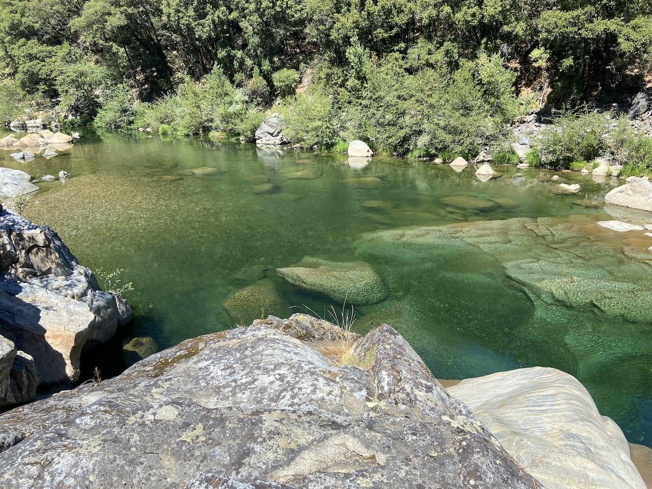
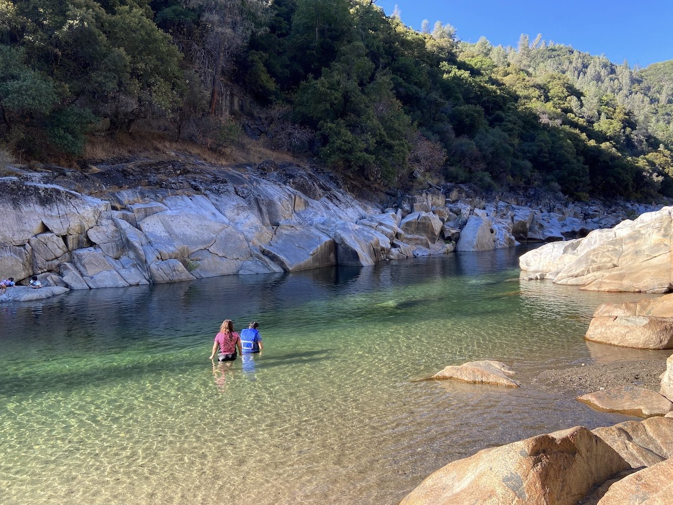
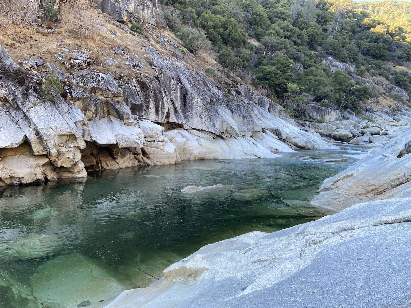
 Cade and I decided to spend the last two days of our trip visiting swimming holes on one of our favorite California rivers: the South Yuba. We checked out some new swimming holes near Purdon Crossing yesterday, and we returned to Lemke’s Lagoon and the Highway 49 area today. I’m not dedicating a separate entry to the latter since I’ve already blogged it and don’t have many new developments, so this entry will mainly focus on our explorations at the Purdon Crossing area.
Since yesterday was a Sunday, we figured all parking areas for the river would be crowded. However, Purdon Crossing seems to be slightly less popular (which is not saying much) than Edwards Crossing and Highway 49, so we decided it would be better for a weekend. A while back, I had scanned Google Earth and marked nine points of interest (POIs) on the five-mile stretch of river between Purdon Crossing and Edwards Crossing, numbered in order from downstream to upstream. We checked out POIs 1 and 2 in 2019, and we checked out POIs 5 and 9 in 2021 (6-8 were on private property, so we were unable to get to them). POIs 3 and 4 were never a high priority, as they didn’t look terribly interesting on Google Earth, but I figured we might as well complete our explorations of this section of the river since we were in the area.
After we ate breakfast at Tofanelli's, we extended our stay at the Grass Valley Courtyard Suites, and then we drove about 25 minutes from Grass Valley to the Purdon Crossing bridge. There happened to be one car leaving the parking lot when we arrived, so we were lucky enough to snag a spot without having to park further up the road. We took the trail about 1.5 miles until we found a side trail between POIs 2 and 3. The main trail was pretty high above the river in this area, and I thought there might be a closer side trail ahead, but Cade wanted to go down here. It came out in an uneventful area closer to POI 2, so we rock-hopped upstream along the bank. It took us a few minutes to reach POI 3.

It looked like a legit swimming hole, but I wanted to check out POI 4 just upstream before taking off my hiking boots and ditching my backpack. We were mostly able to work our way along the rocks between POIs 3 and 4, but there was one large rock jutting over the river with deep water beneath it that we had to climb over/through.

There was only one person at POI 4, and he was just sitting on a rock and chilling on the opposite side the river. When we got a good view of the pool, it looked long and broad, but shallow.

However, I’ve learned that looks can be deceiving in clear water, especially from far away, so I decided to snorkel it anyway. Cade wasn’t interested, so he headed back to POI 3. It got deeper as I snorkeled up the river-left side of the pool. I found one spot where jumping was possible from about 8-10 feet and did it.

I went all the way up to where the rapid fed into the pool, and then I snorkeled down the river-right side.

I found another jump of about 6-8 feet, which I also did (it was on the back side of a nook, so it wasn’t visible from downstream). The pool was 10 feet deep or more in many areas and ended up having a little more going on than the view from the downstream end suggested. It actually took me a while to snorkel the whole thing.
I made my way back to POI 3, where Cade was now on the opposite side of the river. He said he had fallen in twice with his backpack, as he underestimated the depth along the edge just upstream of the swimming hole.

The guy who had been at POI 4 was now here as well. I snorkeled the pool while Cade lay his stuff out to dry and reapplied sunscreen. The bottom of the upstream end of POI 3 was solid granite bedrock, which had a wavy pattern with some rock ridges sticking up.

I found one potential jump of about 6-8 feet near the downstream end of the pool.

I got out to reapply sunscreen, and a group of five people showed up and started inflating inner tubes with a battery-powered pump. I talked to one of them, and he said they planned to tube back to the bridge. He asked how close we were to Edwards Crossing, and I told him we were less than halfway. I asked if they had tubed from Purdon Crossing to Highway 49, and he said they had, but it ended up being too long, and the rapids were more intense. He said the Edwards-to-Purdon section made for a chill float. I asked where they had gotten their tubes, as Cade and I were thinking of buying some, and he said they were from the Big 5 Sporting Goods in Grass Valley. The tubers put in and started floating downstream, and I jumped from the spot I had scoped out earlier. Cade jumped as well.
We headed out around 4 PM and took the trail where we had seen the tubers come down. It ended up being a rather lengthy switchback up to the main trail. We were surprised to pass a middle-aged couple and their dog on the way up. They seemed surprised to see us as well, and they assured us we were on the right track.
When we reached the main trail, we hiked downstream to POI 1, aka China Dam (photos from 2019):


A couple arrived from downriver about the same time, and the woman asked if I knew where the "Emerald Pool" was (a sign on the trail had indicated POI 2 as the Emerald Pool). We told her it was upstream, but we assumed they were looking for the Emerald Pools near Lake Spaulding. I showed her a picture of POI 2 and of the real Emerald Pools, and she said the latter was probably what they were looking for. After hearing it was a long way up the road, they decided to just chill here (an apt choice). I jumped from the rock wall on the river-right side and saw that the tubers were here. I also considered doing the river-left jump, which I had chickened out of last time because of having to jump out far enough to clear the finger-like rock projections about halfway down the cliff. I came to the same decision this time after standing at the top and looking down, so I jumped from a lower spot, and we headed downstream.
There had been a couple of other spots that looked like potential swimming holes we had noted on the way in, but one of them turned out not to be anything interesting when I got up close and looked (I didn’t take a picture of it). The other was near the trailhead.

I had photographed it from the trail last time, but we didn’t go down to check it out. We did this time, and it was a legit swimming hole.

Cade seemed ready to leave by this point, so I “quickly” snorkeled the pool, which probably took about 10-15 minutes due to the size of it. The water was over 10 feet deep in most areas, but there were only a couple of spots against the rocks on the river-right side that were deep enough for jumping. I did a couple of jumps ranging from 6 to 10 feet, and then I put my hiking boots back on. I took the water temperature here, and it was 72.5 °F. The tubers had floated through while we were there, and Cade said he heard one of them joke that he thought we were following them. When we got back to Grass Valley, we went to A Taste of Thai for dinner, and I downed a plate of Pad Thai.
___
This morning, after eating an excessively large triple decker club sandwich at Tofanelli's and checking into my Southwest flight, we drove out to the Highway 49 crossing of the South Yuba River and hiked to Lemke’s Lagoon (see my 2017 entry for a detailed trip report of this area):


I ended up doing the high jump (about 20-25 feet) for the first time.
After alternating between snorkeling, jumping, and lounging at Lemke’s Lagoon, we decided to try making our way downstream to Hoyt’s Crossing through/along the river. That ended up taking much longer than the trail due to trying to keep my backpack dry, but I finally got to see the long chute swimming hole above Hoyt’s Crossing up-close (first photo from 2017):


I had to keep the camera pointed mostly upstream to avoid the nudists. After we got to the end of the chute, I snorkeled the entire pool and slid down the sloped side on the river-left (which I almost did unintentionally with my backpack on earlier). I was hoping there would be some jumpable spots below the cliffs on the river-right, but it was shallow beneath those. Cade waited at the downstream end and said he saw the tubers from yesterday (I'll bet they really thought we were stalking them by this point 😂). Here's a photo of Hoyt’s Crossing from 2017:

After I completed my explorations, we hiked back to the car and ate at the Thirsty Barrel Taphouse & Grille in Grass Valley for dinner.
__
In summary, POIs 3 and 4 upstream of Purdon Crossing didn’t top anything we’d previously seen on this stretch of the river, but they didn’t disappoint, either. Although some South Yuba swimming holes are more exciting than others, I have yet to encounter one that I thought was lame. POI 4 was much larger than 3 and had a little more going on than I assumed from first glance, but it’s also a little less accessible and doesn’t have as many flat lounging rocks that are reachable without swimming. POI 3 was still fairly large with a low jump, and it was more geologically interesting than 4. Even though these two POIs are accessible by trail, they’re still over two miles from either crossing, apparently making them less crowded even on a weekend. Now that I’ve checked out all my (legally accessible) POIs between Purdon and Edwards Crossings, I would say the highlight is POI 1 (China Dam), followed by POI 5, which is the largest and probably receives fewer visitors on account of it being more than a two-mile hike from the road in either direction. POIs 2-4 aren’t necessarily standouts, but they seem to offer a bit more seclusion since the swimming holes closer to the road draw off the exercise-averse crowds. I think it would be fun to tube this entire section of the river on a future trip, which would allow us to legally(?) float through POIs 6-8.
As for the Highway 49 area, it was nice to return there after five years. I would say Lemke’s Lagoon still ranks as one of my top swimming holes on the South Yuba. It was also cool to finally explore the chute swimming hole above Hoyt’s Crossing. It didn’t have any safe jumps, but there were some fun sliding opportunities down the sloped granite bedrock lining the river.
This concludes our fifth California swimming hole marathon (I hesitate to say “fifth-annual” since we now seem to be in the pattern of doing them every other year). Normally I rank the swimming holes we visited at the end of a trip, but the best ones were places we had already been to, and most of the new ones were bamboozled by less-than-ideal weather and/or hydrological conditions (especially the Yosemite ones), so I will have to suspend judgement on those until I can pay them proper visits in the future.