Exit Falls
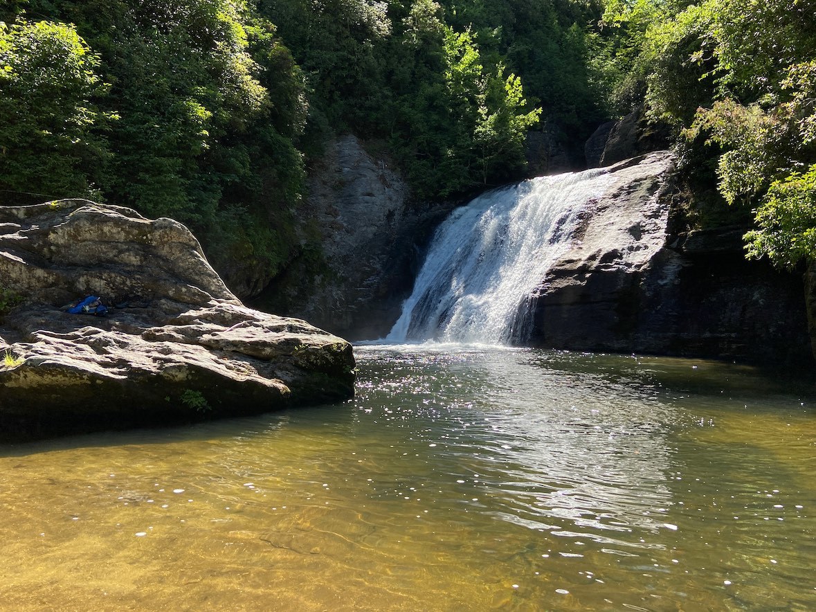
Jun. 18th, 2022 11:59 pm Today I hiked to Exit Falls on the Whitewater River. For some reason, I hadn’t really gotten the swimming hole itch when the weather started getting warm this year, but then I went home for EmilySarah’s wedding last weekend, and the summer mountain weather got me in the mood. It looked like there was going to be a rare stretch of warm, dry weather in the mountains starting this weekend and continuing into next week, so it seemed like a good time to hit up some of the larger rivers that are too rough for swimming after periods of heavy rainfall. That of course includes the Linville River, but I’ve also been wanting to focus on the four major rivers that feed into Lake Jocassee (the Whitewater, Horsepasture, Thompson, and Toxaway Rivers). I had checked out most of the Thompson last year, and I have unfinished business at the Horsepasture (which I plan to visit tomorrow), but I wanted to start things off with the Whitewater River, since I haven’t explored it at all (aside from viewing Upper Whitewater Falls from an overlook on a family vacation when I was 11).
I’ve read trip reports about a series of lesser-known waterfalls upstream of Whitewater Falls, but there’s no official trail, so accessing them requires a combination of old logging roads, bushwhacking, and river-walking. While a few of the falls apparently have swimming holes, the only one that looked worthy of making a special trip for (from a swimming hole perspective) was Exit Falls, which is situated where the river exits a slot canyon, thus the name. People who visit all the waterfalls in one trip generally do a shuttle hike with one car on the downstream end of the route (where NC 281 crosses the river) and one car on the upstream end. Since Exit Falls is much closer to the upstream end, I opted to approach from that direction. Kevin Adams gives the directions for this approach in the third edition of his North Carolina Waterfalls book from 2016, but the updated listing on his website says he no longer advises that route because it’s overgrown. He mentions that there’s an easier route, but it crosses through private property. When I hear "overgrown", I envision a path that hasn’t been pruned in a while. Another blogger’s trip report gave the GPS track for the legal route, so I figured I could put his waypoints in my GPS and use them to stay on track.
This morning, I departed my hotel in Asheville (well, Fletcher technically) and drove out to Sapphire, where I crossed the Whitewater River. When I was almost to the trailhead, the road climbed very high up the mountain, and there was an overlook of Lake Jocassee.

When I got to the parking area, a couple, who said their names were Cole and Rebecca, arrived shortly after me. They said they were also going to Exit Falls and possibly to see the slot canyon above it, so we started hiking together. They said they also planned to go to Devil’s Fork State Park (on Lake Jocassee) later in the day. They were apparently using the same trip report I was. The route started off well defined on old logging roads, but after a few turns, it basically gave out into a bushwhack. We thought we had lost the trail but could pick it up again at the next waypoint. We stuck together for a while, but I said I was going to go a little further in the direction we had been heading to see if I could find the trail. I lost track of them after that.
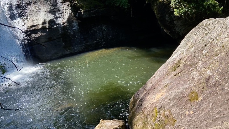
I had some pruning shears with me, and I clipped branches and briars as I went, hoping this would make it easier to find my way back. I had unfortunately forgotten to log into my fitness tracker while I still had internet, and it doesn’t allow offline log-ins, so I had no way of tracking my route (this was the worst possible day that could have happened). Every time I found something that looked like a potential path, it gave out after 10 or 20 feet. I went down into a large ravine with a stream at the bottom. This ravine was absolutely dense with rhododendrons and other nastiness in every direction. I was on the verge of having an anxiety attack when I saw how far I had gone versus how far I had left to go. Going in any direction from this point looked horrible. I decided to press on, hoping I would get to the waterfall and find the “real” path once I got there. I meticulously clipped my way through this nasty ravine and slowly made my way up over the next ridge to a waypoint that was supposed to be an old logging road. I was looking forward to this, but the road was so overgrown that it might as well have been untouched forest. An apparent path left the "road" and went down into another cluttered ravine. I was kind of wigging out at this point, as it had taken me over two hours to get here, and I had no idea how long it was going to take me to get back. I could hear the river and knew I was adjacent to the slot canyon, so I decided to move toward it in hopes that there would be a more defined path. I thought I heard voices at one point, but it was probably just a sound-mirage from the whitewater. I was hoping that Cole and Rebecca had found an easier way to get there and could enlighten me, but I assumed they had probably cut their losses and gone on to Devil’s Fork (if they did, then their day was probably better for it). There was a faint path near the rim of the slot canyon, so I muddled through it until I reached a small stream that spilled in next to the Exit Falls plunge pool. The directions said to keep going until I got well downstream of the pool and look for a rope descent, but at this point, I was going to take the most direct path I could find. When I FINALLY made it out of the clutter, I scaled down the wet, sketchy cliff where the stream trickled in and climbed onto the large boulder opposite the falls.


It was almost 4 PM by this point. It had taken me three hours to get here. This was definitely a nice-looking spot, but any awesomeness to be enjoyed was eclipsed by anxiety over what I had to do to get here (and what I would have to do to get back). Cole had said something before we veered into bushwhacking about “weekend warriors” who come up from Atlanta thinking they can find their way around in the woods. Now I couldn’t help thinking that I was that guy, but if I was, then this was guerilla warfare. I crossed the river and saw a defined path, and it led to a rock face with a huge rope and a metal blaze at the top that said “Hiking Trail”. I assumed this was the “short easy route” that passed through private property. At this point, I was about ready to just take it and let them cite me for trespassing.
I wanted to just get out of there and get back to the car, but I figured I ought to at least scope out the swimming hole after all the trouble I had gone through to get there. The water was pretty cold, in the low 60’s I’m guessing (I forgot to take the temperature while there, but I did so at the road bridge later, and it was 65 °F). I had mainly been wanting to see if the water was deep enough for jumping from the boulder opposite the falls, but the pool was cluttered with submerged boulders and deadfall in that area, so a jump there was not possible.

I didn't swim closer to the waterfall to see how deep it was up against the cliff, but I could see that the water was over my head moving in that direction. I crossed back over to the opposite side of the river downstream of the falls.

There was a sleeping bag there, so I was hoping someone had left their stuff and was planning to return for it, but it looked like it had been there for a while when I looked closer. There was also a cave or tunnel in the rock wall with light shining through from above.
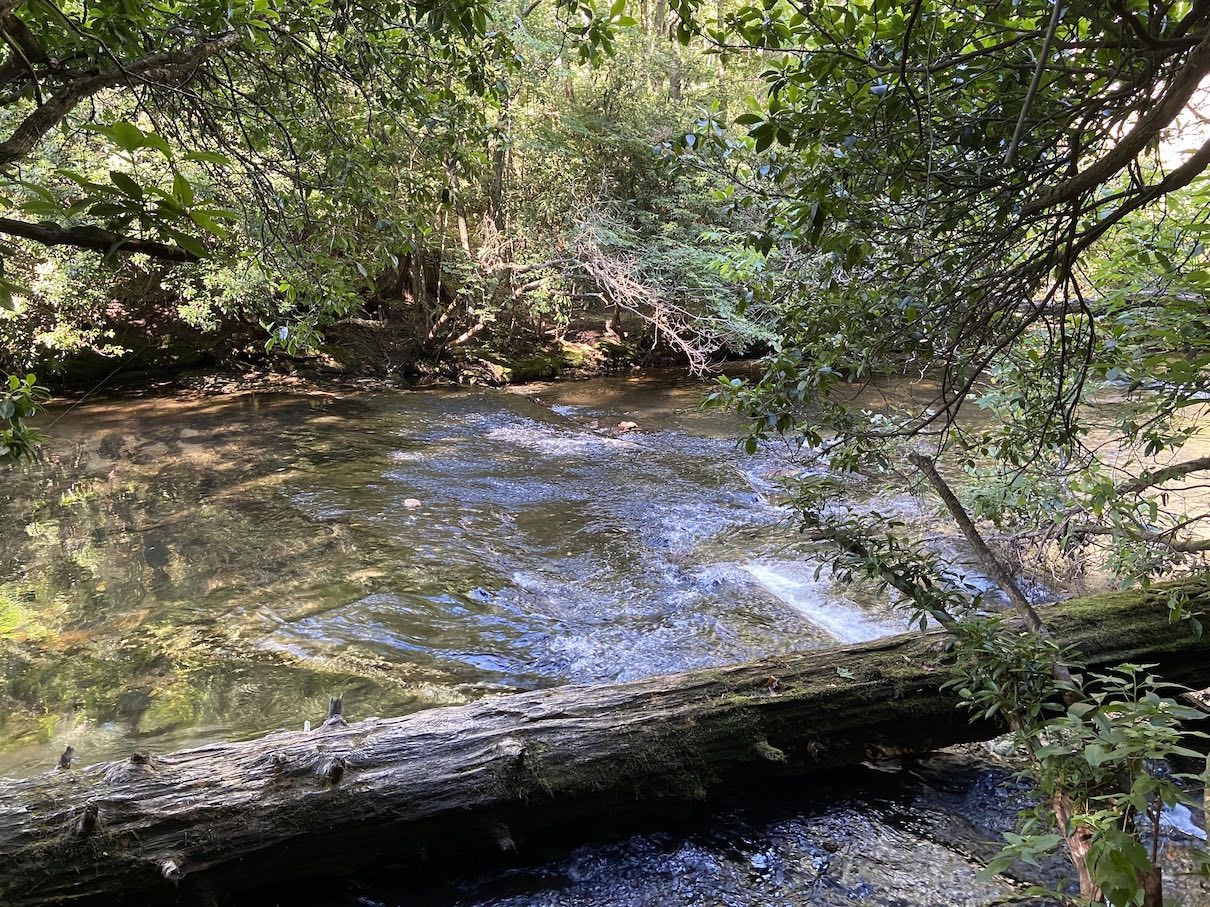
It was a little after four, so I decided I should get going while I had plenty of daylight. I considered taking the tresspass trail, but I figured going back the legal way wouldn’t be as hard as coming in since I had clipped a path I could follow (I’m going to go ahead and say that was the DUMBEST decision I made all day). I was easily able to follow my path of clipped branches back up to the old logging road, but I lost my trail after that point and ended up bushwhacking through that horrible ravine AGAIN. This time, I didn’t bother with the clippers; I just plowed through it like an angry bear (which, I mean, I was pretty over it by this point). The whole “don’t put your feet where you can’t see” rule was out the window; the foliage was so dense that I couldn’t even see what was below my waist at times. I finally came to a familiar looking cascade on a small stream that I had seen before splitting up with Cole and Rebecca, so I knew I was getting close to the defined path again. By the time I got there, it had been two hours since I left Exit Falls. At one of the forks we had come to near the beginning of the hike, I saw metal blazes on the path that the directions said not to take. They matched the blaze I had seen at the swimming hole, so I wondered if this is where the trespass trail would have come out. I followed it a short distance out of curiosity to an uneventful section of the river.

It looked like the trail may have continued on the other (river-left) side. I believe that side is outside the public land boundary, but I saw no signs indicating this (there may have been some over there, though). I walked back to the car and admired the stinging sections of exposed epidermis on my fingers where I had overused the clippers to the point of creating blisters that subsequently popped.

Note to self: don’t use pruning shears without gardening gloves! I was pretty glad I had them at the time, but in hindsight, if I hadn’t, then I might have just given up early into the trek and gone elsewhere (as I should have). I was also glad I wore long pants, which I never do for summer hikes, but it's good that I wore them today. My legs got a little scratched, but not as badly as when I do bushwhacks and creek-walks in shorts. My arms, on the other hand, look like I tried giving a bath to a feral cat. The weekend warrior triumphs! (just kidding, this might be my most regrettable excursion to date)
I was exhausted, crusty, and starving by this point, so I just wanted to grab some fast food and swing by the pharmacy for some supplies to treat the raspberries on my fingers before turning in for the night, but I was far too disgusting to be seen (and smelled) in public at this point. I drove the hour and a half back to Asheville in the aura of my own stench and took a much needed shower, then I went to CVS and acquired some alcohol swabs and liquid bandage. That stuff stung like a BEOTCH, as I knew it would. I then when to Ruby Tuesday, which was right next door to my hotel, and I got a bacon cheeseburger and a wild berry margarita (which I don’t think had much booze in it.. it just tasted like a berry lemonade, which I guess was fine since I was hungry and probably too dehydrated for alcohol to be a smart idea). I think I consumed my food too fast, because I was a little nauseous afterwards, but I felt fine after chilling in the hotel room for a few minutes. This weekend warrior is ready for bed.
In summary, this excursion was such a doozy that I almost forgot I even went to Exit Falls. I mean, it’s a pretty waterfall and swimming hole, but I hesitate to pass judgment on it since I was preoccupied with the horrible bushwhack (in fact, this entry is mostly about that, with Exit Falls thrown in as an afterthought… but that was honestly the overall vibe of this misadventure). Even though the pool is surrounded by cliffs, I’m not sure there would be any serviceable jumps due to the vegetational clutter on top. I have seen a video were rappelers climbed halfway down the waterfall and jumped the rest of the way into the pool, but you couldn’t do that without a rope. But yeah, "overgrown" and "hard to follow" are understatements for the current state of this (former) route. Those descriptions are from 5 and 6 years ago. Succession has run its course, and this former route is now just a straight-up bushwhack with no discernible trail to speak of. I might be interested in checking out more of the upper Whitewater River waterfalls if I were with a group of people who had been there before and knew what they were doing, but I don’t think I would come back here alone again.